


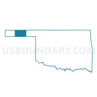
Voting District 302, Texas County, Oklahoma
About
Outline

Summary
| Unique Area Identifier | 655224 |
| Name | Voting District 302 |
| County | Texas County |
| State | Oklahoma |
| Area (square miles) | 382.64 |
| Land Area (square miles) | 380.24 |
| Water Area (square miles) | 2.40 |
| % of Land Area | 99.37 |
| % of Water Area | 0.63 |
| Latitude of the Internal Point | 36.88230260 |
| Longtitude of the Internal Point | -101.81396880 |
Maps


Graphs
Select a template below for downloading or customizing gragh for Voting District 302, Texas County, Oklahoma


Neighbors
Neighoring Voting District (by Name) Neighboring Voting District on the Map
- Voting District 205, Texas County, OK
- Voting District 206, Texas County, OK
- Voting District 303, Texas County, OK
- Voting District 304, Texas County, OK
- Voting District 6, Cimarron County, OK
- Cimarron Township Voting District, Morton County, KS
- Elkhart Ward 2, Morton County, KS
- Elkhart Ward 3, Morton County, KS
- Jones Township Voting District, Morton County, KS
- Rolla Township Voting District, Morton County, KS
- Taloga Township Voting District, Morton County, KS
Top 10 Neighboring County Subdivision (by Population) Neighboring County Subdivision on the Map
- Guymon CCD, Texas County, OK (15,235)
- Taloga township, Morton County, KS (2,327)
- West Texas CCD, Texas County, OK (1,615)
- Keyes CCD, Cimarron County, OK (593)
- Rolla township, Morton County, KS (590)
- Cimarron township, Morton County, KS (60)
- Jones township, Morton County, KS (14)
Top 10 Neighboring Place (by Population) Neighboring Place on the Map
Top 10 Neighboring Elementary School District (by Population) Neighboring Elementary School District on the Map
Top 10 Neighboring Unified School District (by Population) Neighboring Unified School District on the Map
- Guymon Public Schools, OK (12,679)
- Elkhart Unified School District 218, KS (2,474)
- Goodwell Public Schools, OK (1,540)
- Rolla Unified School District 217, KS (759)
- Keyes Public Schools, OK (459)
- Yarbrough Public Schools, OK (415)
Top 10 Neighboring State Legislative District Lower Chamber (by Population) Neighboring State Legislative District Lower Chamber on the Map
Top 10 Neighboring State Legislative District Upper Chamber (by Population) Neighboring State Legislative District Upper Chamber on the Map
Top 10 Neighboring 111th Congressional District (by Population) Neighboring 111th Congressional District on the Map
Top 10 Neighboring Census Tract (by Population) Neighboring Census Tract on the Map
- Census Tract 9646, Morton County, KS (3,233)
- Census Tract 9507, Texas County, OK (3,173)
- Census Tract 9510, Texas County, OK (1,615)
- Census Tract 9501, Cimarron County, OK (1,163)
Top 10 Neighboring 5-Digit ZIP Code Tabulation Area (by Population) Neighboring 5-Digit ZIP Code Tabulation Area on the Map
- 73942, OK (12,953)
- 67950, KS (2,558)
- 73939, OK (1,695)
- 73949, OK (1,688)
- 67954, KS (661)
- 73947, OK (472)